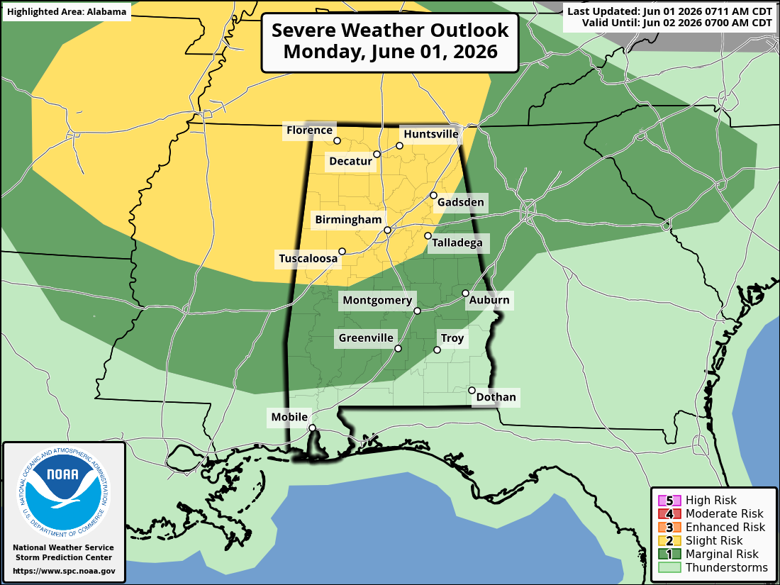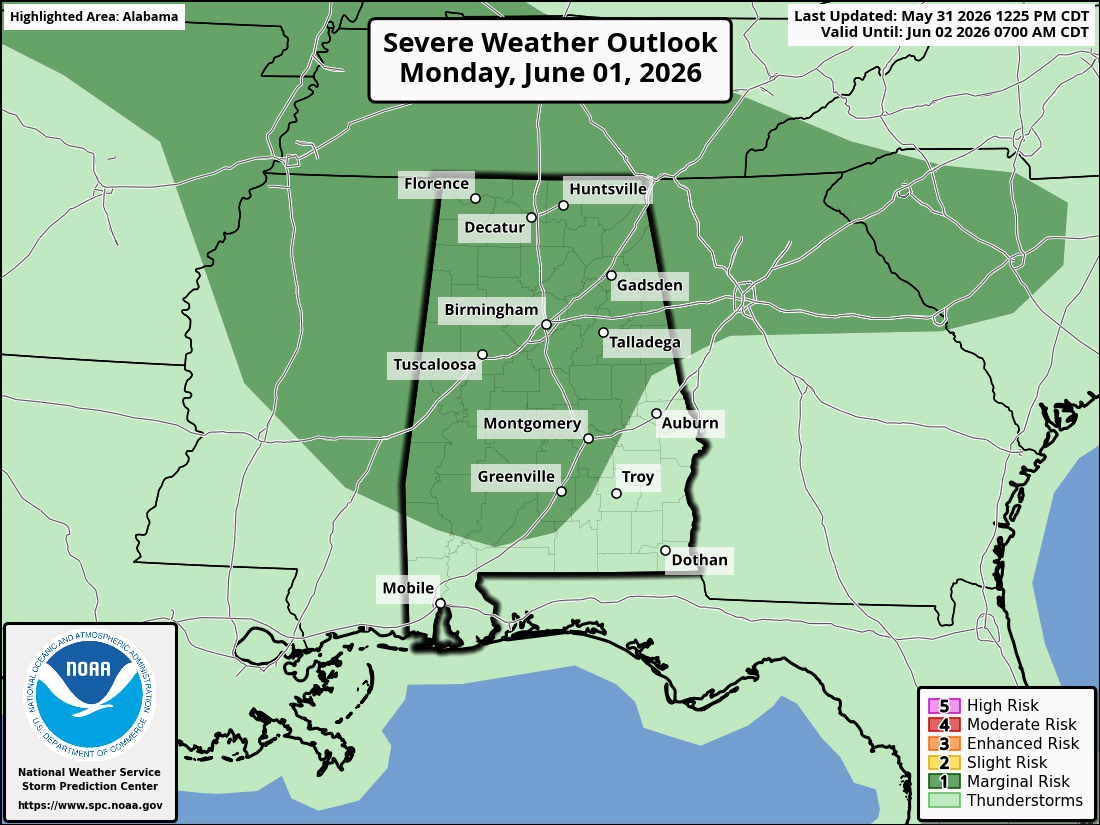
Another Severe Weather setup for today, over a large part of the United States, from the Great Lakes to the Deep South.
Currently a deep surface low is moving over the Great Lakes area and is pulling a cold front behind it that stretches to the Gulf Coast. The ingredients for severe weather will be available today: predicted instability this afternoon, warm temperatures, high dew points, strong wind profiles and an approaching cold front.
Current indications are that thunderstorms will gradually start to intensify along and just ahead of the front, from the Ohio Valley southward into the Tennessee Valley, from late morning into the afternoon. Wind profiles for today are very favorable for the development of organized severe storms. Both discrete supercells and line segments are possible with damaging winds and a few Tornadoes. Timeline should start around late morning to our west into the early evening hours.
Estimated timeline for the Alabama area should be around 3:00 pm – 9:00 pm for northwest Alabama and 5:00 pm – 1:00 am for central and northeastern Alabama. Again, those are estimates.
Remain weather alert today and tonight.