Outlook for Sunday, April 14, 2019
The chance for Severe Weather will start on Saturday, across the deep South.
Summary of what to expect on Saturday…
From the Storm Prediction Center:
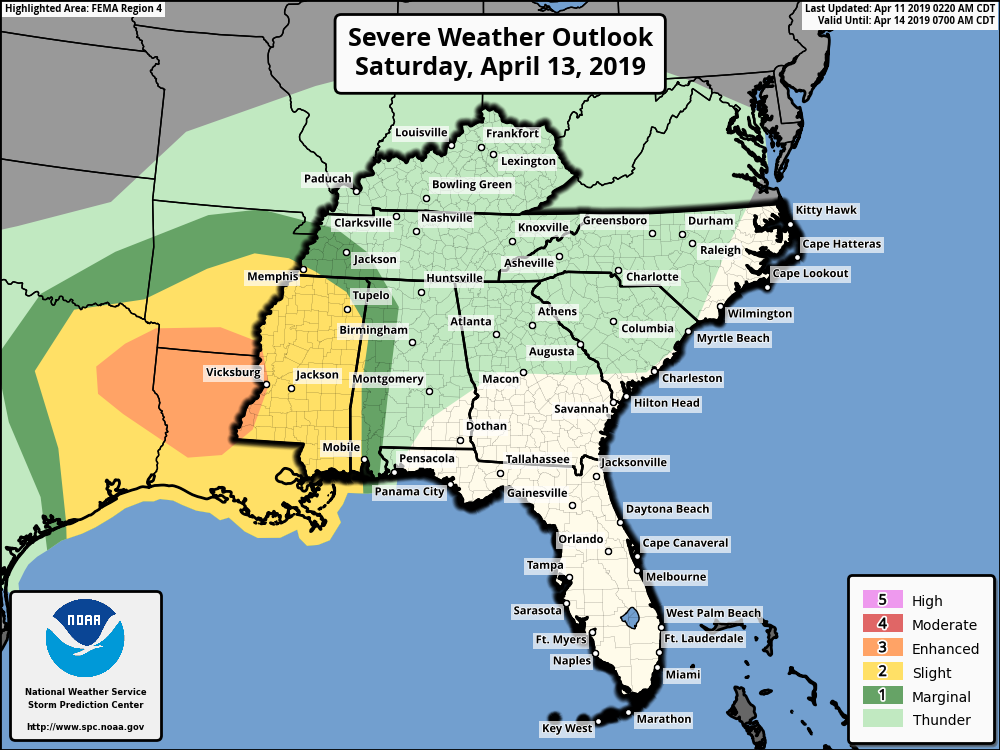
On Saturday numerous severe thunderstorms are expected across portions of east Texas, Louisiana, southern Arkansas, and Mississippi Saturday and Saturday night.
A vigorous mid-level trough initially over west Texas will shift eastward toward the Lower Mississippi Valley Saturday while taking on a slight negative tilt. This system will continue pushing east – potentially reaching western Alabama by 12Z (7:00 AM) Sunday.
There is currently an “Enhanced Risk” (3 out of 5) area for Severe Weather on Saturday over much of Louisiana and East Texas, surrounded by a large “Slight Risk” (2 out of 5) area.
You say why are we talking about weather so far away from our area? Well, because this system and Severe Weather will track toward Alabama on Saturday night. Depending on the speed of movement, it could very well start effecting Alabama early on Sunday morning and through the morning hours.
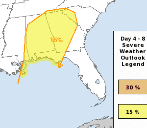
The Storm Prediction Center does the Severe Weather Outlook maps for each day, valid from 6:00 AM to 6:00 AM. Thus, this is why there looks to be a gap somewhat between Saturday and Sunday. The outlined area for Saturday will track eastward and depending on the time of day it reaches the Alabama will help determine some of the strength of storms we see. Right now, there is a chance of damaging winds and a few tornadoes possible with this system. We are still several days out, so expect this forecast to change some as we get closer. Stay up to date and weather alert this weekend, especially Saturday night into Sunday.