This is an article from the Alabama Emergency Management Agency.
By Jim Stefkovich, Meteorologist, Alabama Emergency Management Agency
CLANTON – Thursday, 10 am, April 9, 2020
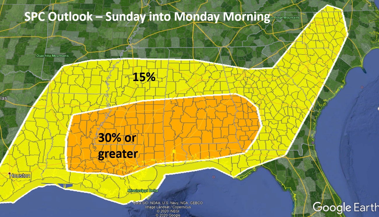
The words possible “severe weather outbreak” are being used to describe the unfolding event for Sunday afternoon into early Monday morning. In the map above, the Storm Prediction Center (SPC) has included almost all of Alabama under a threat.
Let’s talk about the weather first, and then what you should be doing right now to prepare. Concerning percentages, the area in yellow represent at 15%, and the orange area a 30% or higher chance of severe weather anywhere within 25 miles of a point. Typically, the chance of severe weather for most events is low, so these percentages are actually very, very high.
Unfortunately, it appears the bulk of the activity will occur from Sunday afternoon into early Monday morning, including supercell development with the potential for long-tracked EF2 or stronger tornadoes. Don’t focus on specific counties and percentages at this point, as this is looking like a statewide event. It is very possible the higher threat area will extend northward in later updates.
For those that depend upon community shelters during severe weather, today and Friday is the time to contact your local Emergency Management Agency and find out if and when they will be open, as well as any possible restrictions due to the ongoing virus pandemic. It is TOO LATE if you wait until the weekend to find out this information.
Review your safety plans before Sunday, be able to receive watches and warnings from multiple sources (do not count sirens), and act immediately if a warning is issued. You can find out more information by going to https://www.ready.gov/severe-weather


