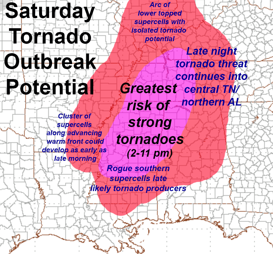
A significant SEVERE WEATHER OUTBREAK, including the threat for Strong Tornadoes, appears likely over Southeastern U.S. on Saturday, February 23, 2019. Areas affected include Eastern Arkansas and Mississippi on Saturday afternoon. Then North Alabama and central Kentucky/Tennessee evening/late night.
Supercell thunderstorms could start as early as midday in southeastern/eastern AR, with multiple Supercell thunderstorms developing northeast across northwestern MS into western TN, even KY through Saturday afternoon. Some models also show the possibility of isolated “Intense Supercells”, likely STRONG Tornado producers, as far south as southern MS by Saturday mid-to-late afternoon. These could be long-track Supercells moving rapidly through western/northwestern AL into central TN/KY late Saturday night.
This could be a dangerous weather setup, especially across Mississippi, Northwestern Alabama, and central Tennessee and Kentucky late Saturday night.
PREPARE NOW FOR DANGEROUS WEATHER…PLAN FOR YOUR SHELTER AREA AND HAVE A WAY TO RECEIVE WARNING INFORMATION FROM THE NWS.