Thursday, April 18, 2019 Severe Weather –
Northern Alabama escaped the Severe Weather event from last night, but other places to our South and West did not. Remember, any time The Storm Prediction Center puts out a Severe Weather Outlook for a large area, that means conditions are favorable within that area for severe weather to occur. That does not mean severe weather will occur over every square mile of the outlook area. No one can predict the exact location of when or where severe weather and Tornadoes will strike. That is why when The Storm Prediction Center puts out these Severe Weather Outlook areas that everyone needs to remain weather alert in and close to those areas.
Now, onto Thursday, April 18, 2019.
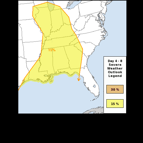
We are now 5 days out and The Storm Prediction Center already has a high concern for Wednesday & Thursday of this week. This week’s Severe Weather event will begin on Wednesday, as states to our west, including in Texas, Louisiana, Mississippi, Arkansas, Missouri, Oklahoma, Iowa, and Illinois, will be under to gun for a severe weather outbreak. Thursday, that system will move east and effect Louisiana, Mississippi, Alabama, Georgia, Tennessee, Kentucky, Illinois, and Indiana.
This system will produce hail, damaging winds, and Tornadoes on Wednesday. How severe this setup becomes, for our area on Thursday, will depend on several factors. The effects of precipitation and cloud cover will play a part for Thursday. Right now, just plan for a chance of severe weather on Thursday across the southeast. If you live within the outlined areas for Wednesday or Thursday of this week…REMAIN WEATHER ALERT ON THOSE DAYS!
Forecasting severe weather is a fluid thing, it changes, and the forecast models get better the closer we get to the event. Things will change between now and Wednesday and Thursday, but plan for some type of severe weather on these days.