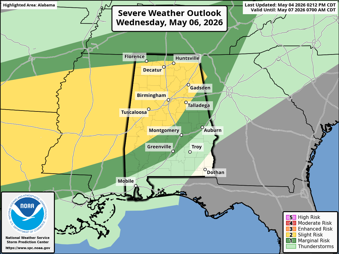
The Storm Prediction Center has placed a large area of the South under a risk of Severe Weather on Wednesday, December 29, 2021. The Severe Weather Outlook for Wednesday includes parts of AR, AL, TN, and MS.
Severe Thunderstorms are forecast for parts of the Southeast into the Tennessee Valley on Wednesday and Wednesday night. Damaging wind gusts, Tornadoes, and Large Hail are possible during the afternoon into the evening. Wind profiles across the region will favor Supercell Thunderstorms, should Storms be able to develop.
Currently, forecast models are showing a couple of areas of concern on Wednesday, that may be capable of triggering rotating Supercell Thunderstorms. The first area of concern is near the Mississippi River into Northwestern portions of Mississippi. This area could see storms developing around 12:00 Noon – 3:00 PM Wednesday afternoon.
The second area of concern is from South Central Mississippi into Northwestern Alabama. This area could see storms developing between 5:00 PM – 10:00 PM.
Don’t be scared, but just be aware, that Severe Weather is possible on Wednesday and Wednesday night across the South. If you live anywhere in the Dark Green (Marginal Risk Area, 1/5) or the Bright Yellow (Slight Risk Area 2/5), plan now and have a plan of action ready, if Severe Weather threatens your area.
Again, conditions are favorable on Wednesday and Wednesday night, in the current outlined area, to see Damaging Winds, Large Hail, and Tornadoes.
Please be weather alert!


