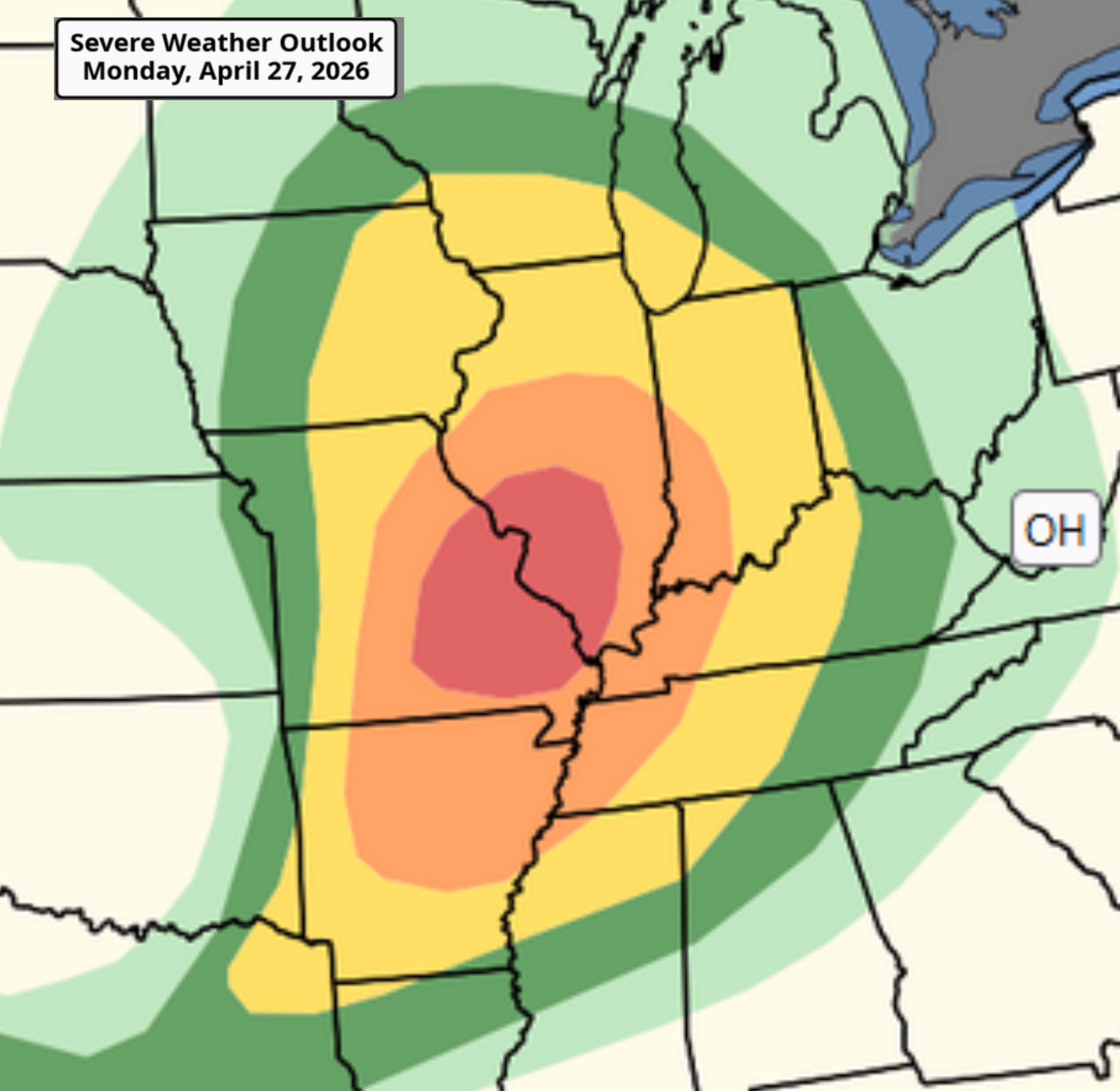
A dangerous and widespread severe weather outbreak is unfolding today across a large portion of the central and eastern United States, with the Storm Prediction Center placing parts of Missouri and Illinois under a Moderate Risk (Level 4 of 5) for significant severe storms.
Forecasters warn the greatest threat today will stretch from the Mid-Mississippi Valley into the Mid-South, where atmospheric conditions are highly favorable for numerous severe thunderstorms capable of producing multiple strong to intense tornadoes, destructive straight-line winds, and very large hail. The highest tornado risk centers on portions of Missouri into Illinois this afternoon and evening, where some tornadoes could reach EF-3 strength or greater.
Farther south, the threat extends into Arkansas, western Tennessee, and portions of the lower Mississippi Valley, where supercells may also develop with tornadoes, large hail, and damaging winds before storms eventually merge into a larger squall line tonight.
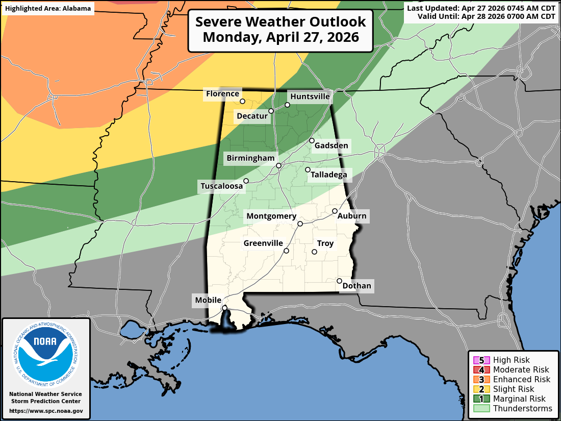
As the storm system pushes east and southeast, North Alabama is expected to remain on the southern edge of the broader severe setup today. While the highest-end tornado threat appears focused well to the north and northwest, North Alabama could still see strong to severe thunderstorms later this evening into the overnight hours, especially as storms move in from Tennessee and Mississippi.
For North Alabama, the primary concerns appear to be damaging wind gusts, heavy rainfall, frequent lightning, and the potential for isolated tornadoes—particularly if storms maintain intensity as they approach the region.
North Alabama Timeline (Best Estimate):
2 PM – 6 PM: Mostly warm, breezy, and increasingly unstable with clouds building.
6 PM – 10 PM: Severe threat begins increasing west to northwest of Alabama, with storms possibly approaching northwest Alabama late evening.
10 PM – 3 AM: Greatest window for North Alabama, including DeKalb County, for strong to severe storms. Damaging winds appear to be the main threat, though isolated spin-up tornadoes cannot be ruled out.
After 3 AM: Storms gradually shift eastward with decreasing intensity.
Residents across North Alabama should stay weather-aware tonight, keep phones charged, have multiple ways to receive warnings, and be prepared to act quickly if watches or warnings are issued. While this may not be the highest-end setup for Alabama, nighttime severe weather can still become dangerous quickly.