Tuesday, November 29, 2022, will bring the chance of Severe weather across a large portion of the South. The Storm Prediction Center has mentioned the threat for Damaging Winds, Large Hail, Tornadoes, and some Long Track, Strong Tornadoes will be possible.
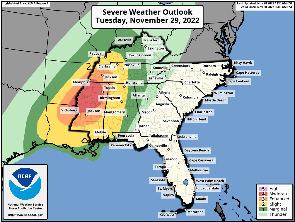
The Outlook Risk Area has also been upgraded and expanded for tomorrow. The Storm Prediction Center has upgraded a large area to a “Moderate Risk” (4/5). The main area for the highest risk, or the bullseyes area, will be across Mississippi. Surrounding the Moderate Risk area includes an “Enhanced Risk” area (3/5), that extends into parts of MIssissippi, Louisiana, Arkansas, and Tennessee.
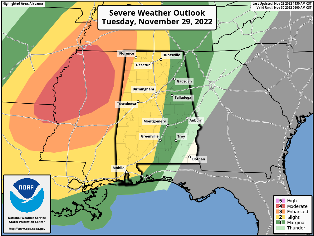
The entire State of Alabama has either a “Slight Risk” (2/5) or “Marginal Risk” (1/5) for Severe Weather on Tuesday/Tuesday night.
There will be the chance for several fast moving Tornadoes tomorrow across the outlooked areas. Some of Tornadoes may be Strong and Long Tracked…i.e. staying on the ground for long periods of time. Just today, The Storm Prediction Center upgraded the risk areas and expanded them farther to the East as well.
There will be a large area of wind shear, from Texas to Kentucky, and any storm that develops in this environment could start to rotate very easily and become Tornadic.
Prepare now and be weather alert!
Below is the most current Severe Weather Outlook from The Storm Prediction Center, as of 12 Noon Monday. This is the state level map. Below that is the Regional Severe Weather Map.