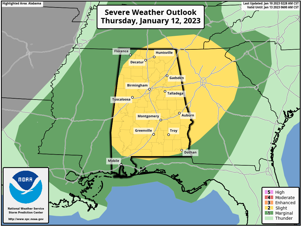
The Storm Prediction Center already has a large Severe Weather Outlook area across the South on Thursday, January 12, 2023. The main threat expected will be damaging winds, but a few brief Tornadoes could be possible across the area.
Below is the latest information from The Storm Prediction Center
 ...THERE IS A SLIGHT RISK OF SEVERE THUNDERSTORMS ACROSS PARTS OF
   THE SOUTHEAST...

   ...SUMMARY...
   Isolated to scattered severe thunderstorms appear possible Thursday
   across parts of the lower Mississippi Valley, Tennessee/Ohio
   Valleys, and Southeast. Damaging winds should be the main threat,
   but a brief tornado or two may also occur.

Thunderstorms should gradually increase in coverage and intensity as
   they move eastward across the Southeast and TN/OH Valleys Thursday
   afternoon. Given the linear forcing of the cold front and enhanced
   low-level flow, isolated to scattered damaging winds will likely be
   the main severe threat. A brief tornado or two also appears possible
   with embedded circulations, even though the low-level flow will tend
   to veer to a more westerly component through the day, gradually
   reducing 0-1 km SRH. Convection will gradually weaken with eastward
   extent across the OH Valley into GA/SC and north FL Thursday
   evening/night as it outpaces the low-level moisture return.