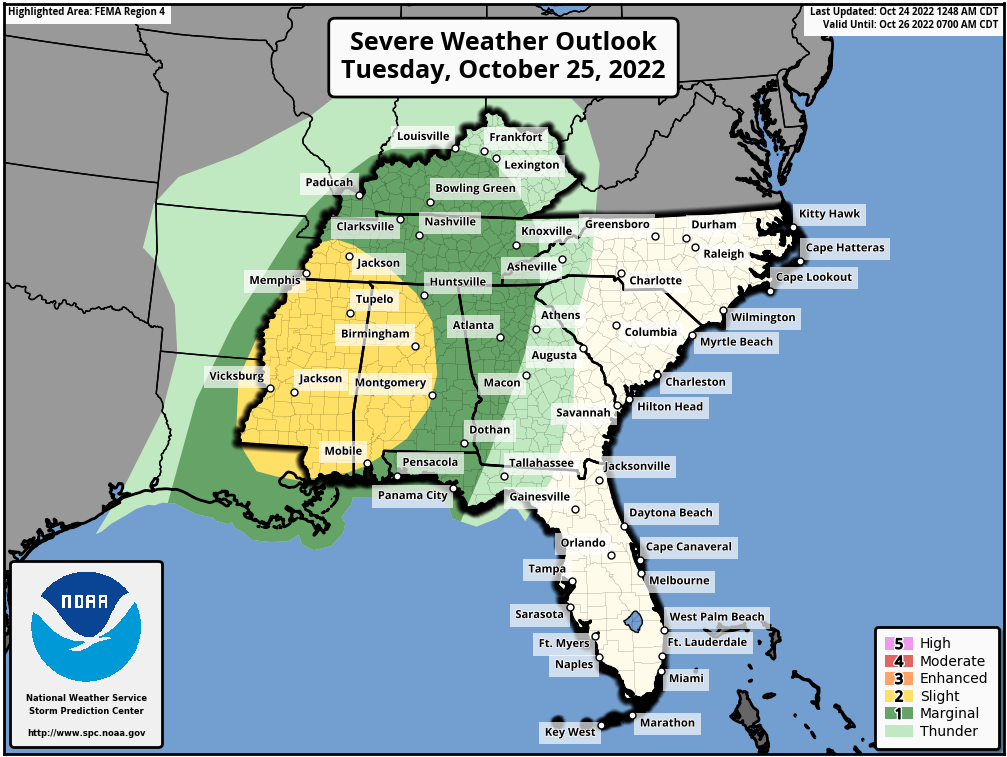
THERE IS A SLIGHT RISK OF SEVERE THUNDERSTORMS FROM THE LOWER MISSISSIPPI VALLEY/MID-SOUTH INTO THE SOUTHEAST STATES…
SUMMARY
Strong to Severe thunderstorms are expected from the Lower Mississippi Valley/Mid-South across the Southeast States on Tuesday.
Damaging gusts will be the primary threat along the line, but strong veering low-level profiles could result in line-embedded/QLCS
Tornadoes as well. The highest Tornado potential currently appears to exist from south-central MS northeastward into west-central AL
where the best overlap between the enhanced low/mid-level flow and upper 60s dewpoints occurs.
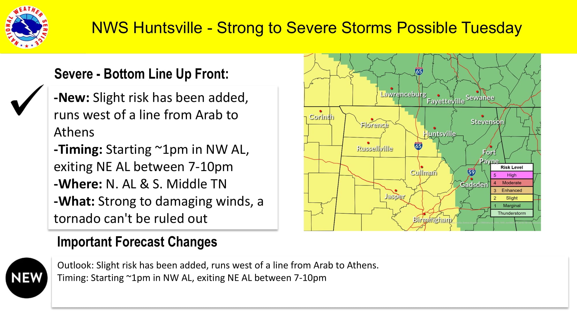
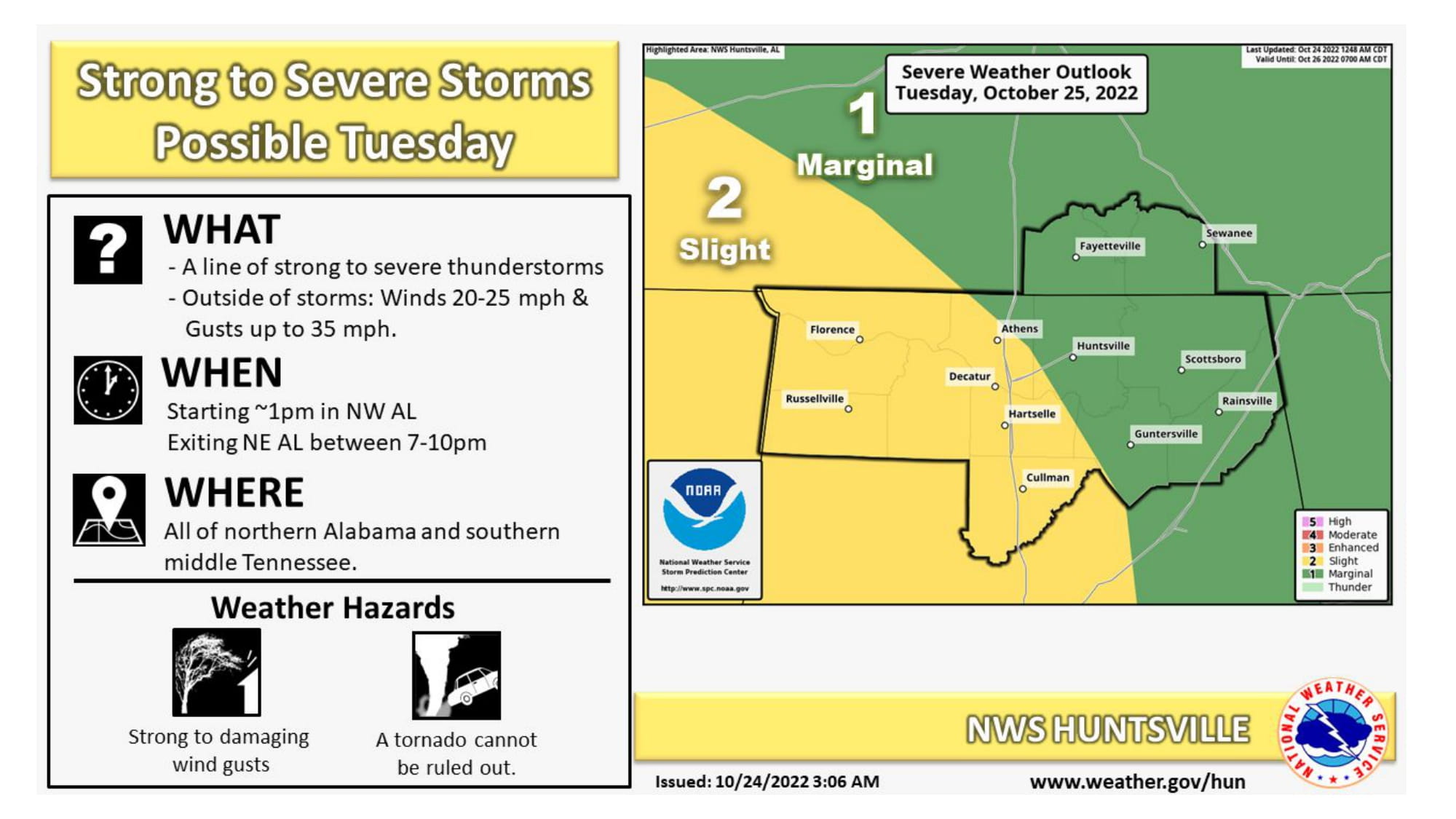
Timeline of North Alabama, according to the National Weather Service in Huntsivlle, Al. Line of Storms should enter NW Alabama around 1:00 PM and exit the NE corner of Alabama between 7-10 PM.
Again, Strong to Damaging Winds and a possible Tornado or two will be possible.