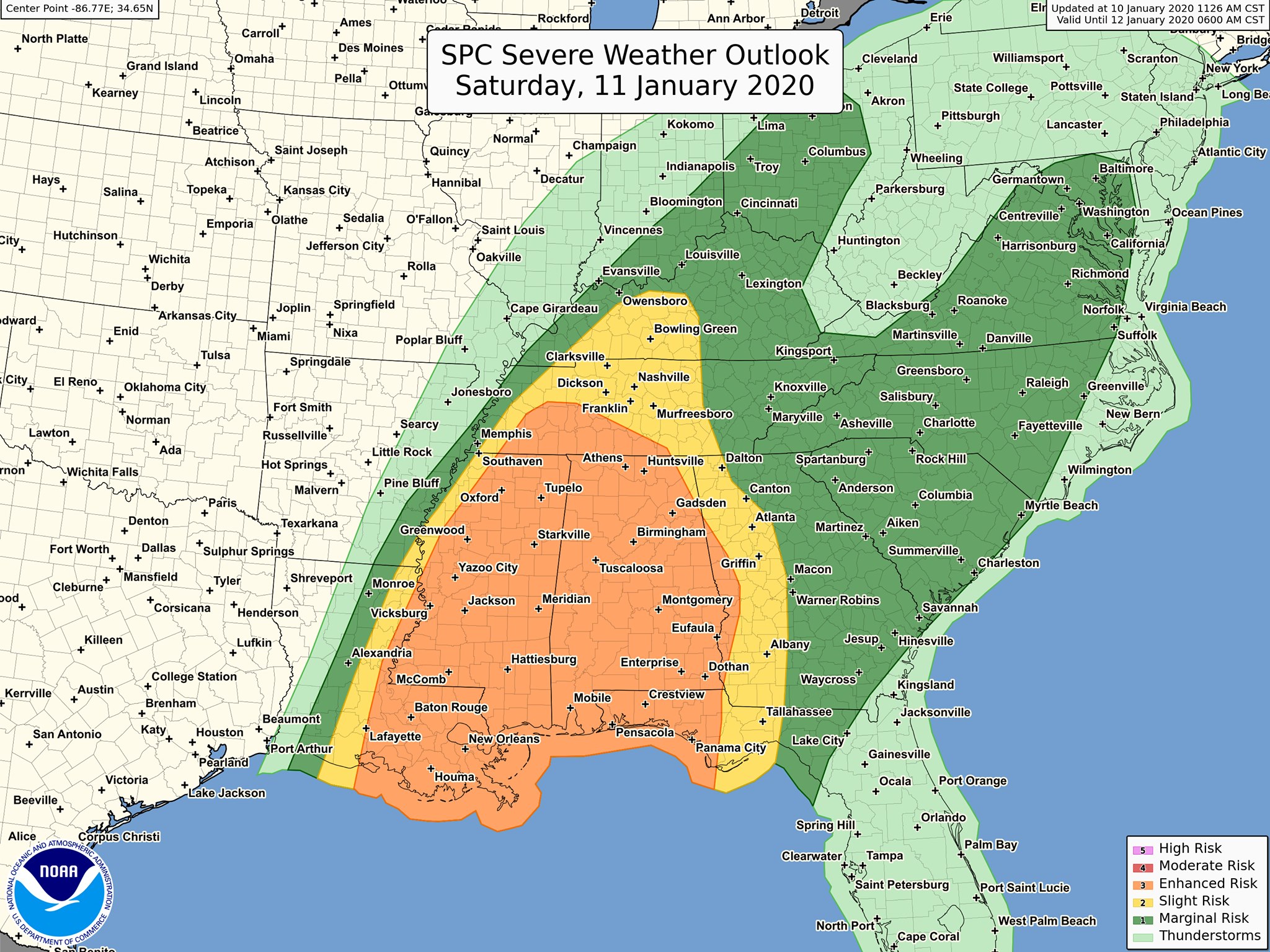
The South has an “Enhanced Risk” for Severe Weather on Saturday, January 11, 2020. This could be a significant Severe Weather Event. Tornadoes and strong Tornadoes will be possible across the risk area, along with Damaging Winds. Plan now for your shelter location on Saturday. Check with your local EMA office to see where local shelters are located in your area and make sure they will be open. If you live in a mobile home or manufactured home, please make plans to go to a shelter on Saturday, for you and your families safety.
Updated forecast for Saturday 1/11/20: A broad area of Enhanced Risk for severe weather is forecast for much of Mississippi and Alabama as well as portions of southeast Louisiana, western Tennessee, and the Florida Panhandle. Widespread damaging winds and tornadoes, some of which could be strong, will be possible in these locations. Stay weather aware. Future forecast updates available at www.spc.noaa.gov.
A squall line with a risk for Severe Wind Gusts will be ongoing Saturday morning from near where Missouri and Kentucky state lines meet, south-southwestward to coastal Louisiana and to the west-central Gulf of Mexico.
Intense wind fields, associated with a 100-kt 500mb jet and an 80-kt southerly Lower Level Jet will gradually shift east/northeastward during the day in association with the progression of the mid-level trough. Dewpoints across the area will reach the lower 60s degrees F range, all the way into middle Tennessee and upper 60s farther south near I-20.
Intense background flow fields will support both the threat for Severe Wind Gusts with bowing segments (bow echoes) in the squall line and a conditional risk for Tornadoes, with any Supercell Thunderstorm managing to develop ahead of the squall line or with stronger mesovortices (small scale rotational features found in convective storms, such as those found in bow echos and Supercell Thunderstorms). As the squall line advances across Alabama into Georgia late in the day, models are indicating less organization in the line as it encounters slightly weaker instability concurrent with the upper system becoming increasingly displaced from the Georgia/North Forida vicinity.
#lawx #tnwx #mswx #alwx #flwx #gawx