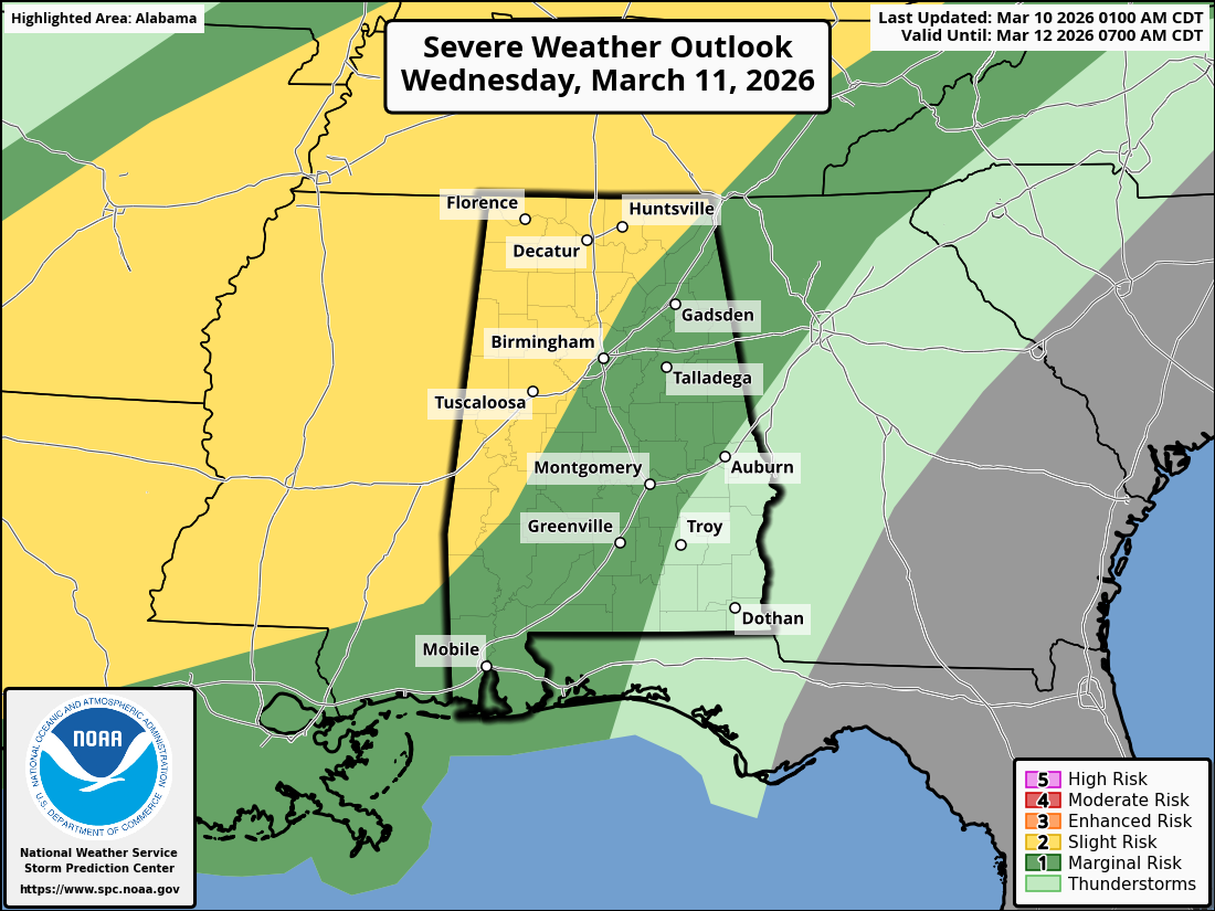
North Alabama could see some severe thunderstorms on Wednesday, but the overall threat level is Slight Risk, which means a few storms could become severe, but widespread severe weather is not expected.
A cold front moving in from the west will interact with warm, humid air already in place across Alabama. This setup could cause thunderstorms to develop along the front and move through the area during the day or evening Wednesday.
For North Alabama, the main threats would be:
Damaging wind gusts from stronger storms
Heavy rain and lightning
A small chance of hail
A very low chance of a brief tornado
Forecasters say the biggest uncertainty is how unstable the atmosphere becomes. If storms earlier in the day limit heating, the severe threat could stay lower. But if the atmosphere warms up enough, a stronger line of storms could develop and produce damaging winds.
Bottom line for North Alabama:
Expect showers and thunderstorms Wednesday, and a few could be strong with gusty winds, but this does not currently look like a major severe weather outbreak.
If you’d like, I can also show you the likely timeline for storms reaching North Alabama (Huntsville, Fort Payne, Scottsboro, etc.) on Wednesday, which may help for planning or for a short social media weather post.