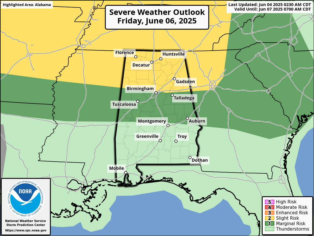
On Friday into Friday night, North Alabama could see scattered severe thunderstorms. These storms may bring strong, damaging winds, especially as they move through the region from the west. The storms are expected to start in Oklahoma and track east-northeast across the Mid-South and into northern Alabama and Georgia. There’s some uncertainty about how far south the storms will reach, but they could impact areas from Kentucky down to northern Alabama. The atmosphere is expected to be warm, moist, and unstable, which could fuel intense storms. While the forecast suggests a moderate risk (level 2), it could be upgraded as more details about the storm system become clearer.
The forecast for North Alabama on Friday into Friday night includes scattered severe thunderstorms with the primary threat being damaging wind gusts. These storms could produce strong, potentially destructive winds as they move through the region. The forecast also mentions the possibility of an MCS (Mesoscale Convective System), which could lead to widespread or intense storm activity. While damaging winds are the main concern, the unstable and moist air mass could also support other severe weather risks typical of thunderstorms, such as heavy rain or possibly hail, though these are not specifically highlighted in the provided outlook. There’s uncertainty about the southern extent and intensity of the storms, but the risk level could increase as the forecast is refined.