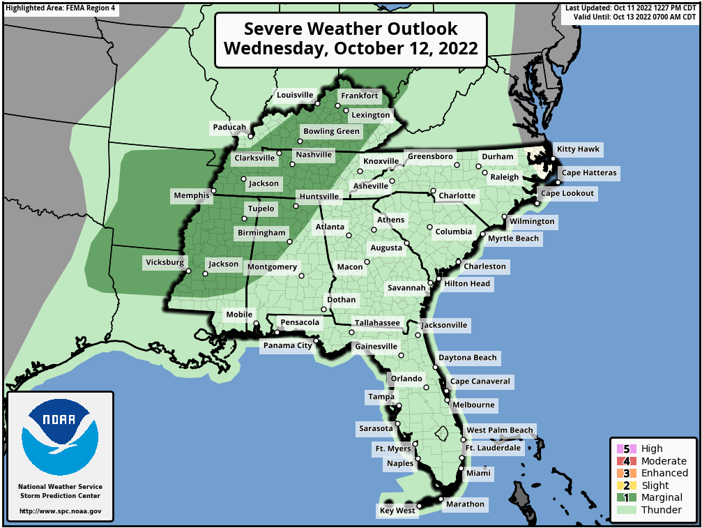
We have had such a nice and calm Fall, but that will all end tomorrow, Wednesday, October 12, 2022. The Storm Prediction Center has placed a large portion of the country under a “Marginal Risk” (1 out of 5) for Strong to Severe storms. The Dark Green area is the “Marginal Risk”.
The main threat window will be mainly during the evening and overnight hours. Some showers and storms will begin to develop during the late morning and early afternoon hours, but these will most likely be below Severe limits. Some of these tomorrow, during the day, may have some gusty winds and some small hail.
For the Alabama area, the main threat window will be from around 9:00 pm Wednesday to 6:00 am Thursday morning (overnight). We should see a broken line of storms develop along the cold front, which will move into Alabama. With this linen of storms, we can see damaging winds and some hail, but an isolated Tornado cannot be ruled out. Again, this isn’t going to be a Tornado outbreak, but a few isolated Tornadoes could be possible. There is enough low-level shear to produce a few.
This again is only a “Marginal Risk” (1 out of 5) and this isn’t going to be a major event, but if you are in the location that gets hit by Severe weather, then it is major to you.
Make sure you have a way to receive weather alerts in the night time hours on Wednesday night into Thursday morning.