
Alabama residents are being urged to stay alert as a high-end severe weather event is expected to unfold from Friday night through early Sunday morning, bringing a significant risk of damaging storms, large hail, and possible Tornadoes.
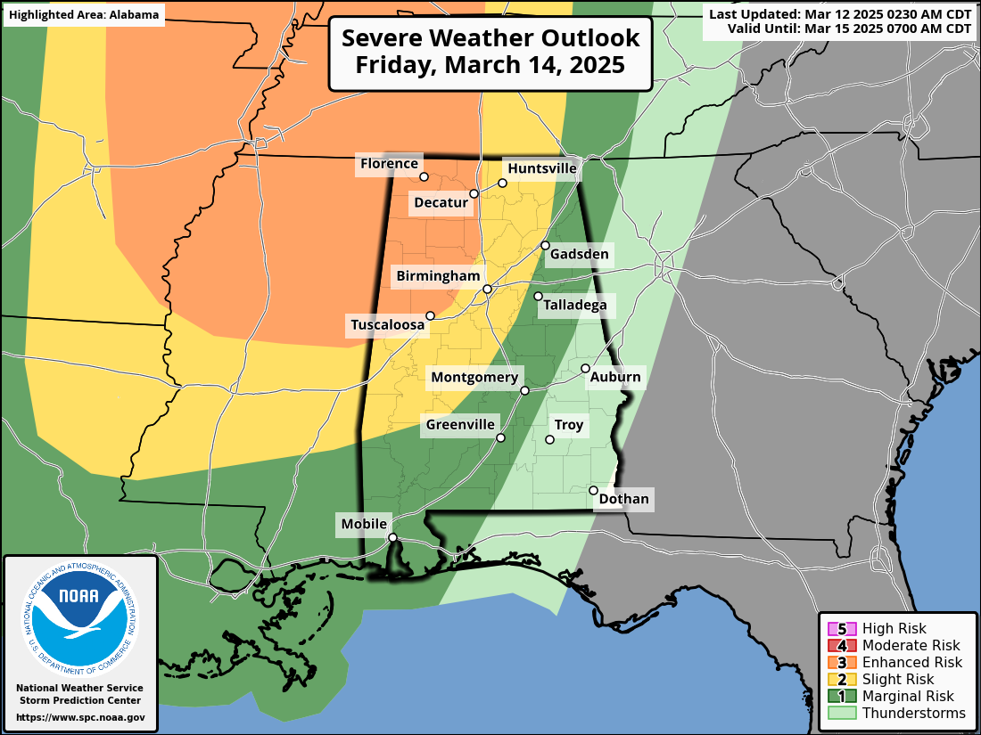
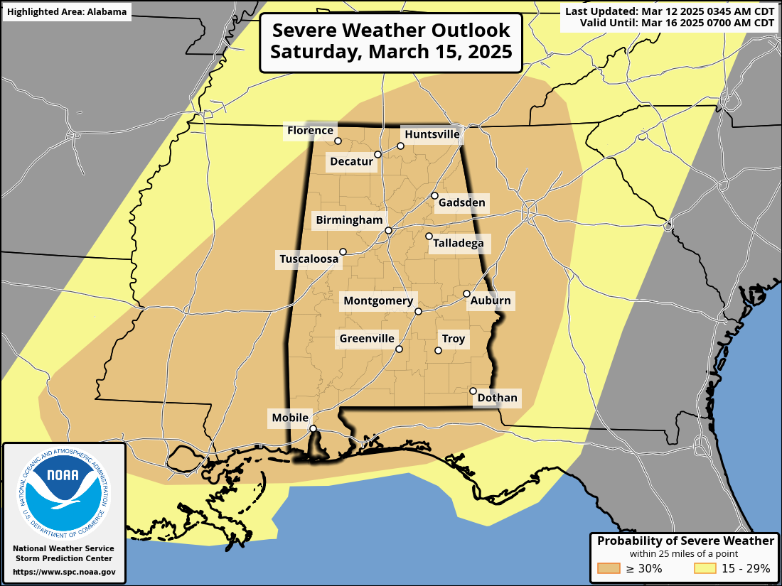
The National Oceanic and Atmospheric Administration’s (NOAA) Storm Prediction Center (SPC) has placed the entire state under an “Enhanced Risk” category (3 out of 5), signaling the potential for dangerous conditions. Some areas could even be upgraded to a higher threat level by Saturday, according to how conditions are, as we get closer to the event.
Two Rounds of Storms Expected
The storm system is expected to arrive in two waves, each carrying the threat of severe weather.
- Friday Night into Saturday Morning: The first round of thunderstorms is forecast to enter northwest Alabama late Friday night, continuing through Saturday morning over the northern half of the state. These storms could bring damaging winds, large hail, and the possibility of a few isolated Tornadoes.
- Saturday Afternoon into Saturday Night: The second and more intense round of storms is expected later Saturday. Forecasters warn that this could be the “main event,” with the potential for large hail, damaging winds, and Tornadoes. Some Tornadoes on Saturday could be strong, long track Tornadoes, classified as EF-2 or higher on the Enhanced Fujita scale. Saturday could be a dangerous day across Alabama.
Weather officials emphasize that the storms should clear out of the state by early Sunday morning, but not before posing a serious threat. Residents are advised to stay weather-aware, have multiple ways to receive warnings, and be prepared to take action if severe weather strikes.
Stay Prepared
Authorities recommend keeping an emergency kit ready, monitoring weather updates, and ensuring access to safe shelter if needed.
As Alabama braces for this severe weather outbreak, residents are encouraged to remain vigilant and heed all warnings issued by meteorologists and emergency officials.