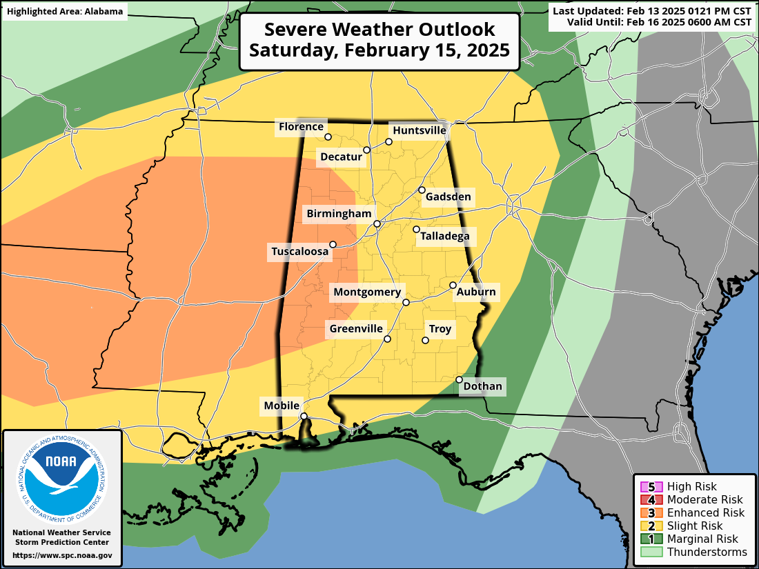
Residents from Texas to Alabama should brace for Severe Weather this Saturday, as meteorologists warn of an “Enhanced Risk” (3 out of 5) area, surrounded by a “Slight Risk” (2 out of 5) area of thunderstorms that will be capable of producing damaging winds and Tornadoes.
According to forecasters, a powerful mid-level trough will move from the Southwest into the Southern Plains before advancing toward the Mid-Mississippi Valley by Sunday morning. This system will bring an extensive warm sector across the Southeast, creating conditions favorable for Severe storms with damaging winds and Tornadoes.
Storm activity is expected to begin in the late afternoon and persist into the evening. East Texas and western Louisiana are projected to experience the most intense thunderstorms due to higher instability. Some of these storms may develop into supercells, potentially producing large hail, strong winds, and Tornadoes and a few Strong Tornadoes.
As the evening progresses, a squall line will form and move eastward, bringing widespread damaging winds and the possibility of embedded Tornadoes. While some storms may develop ahead of this line, their intensity is expected to be lower due to decreasing instability.
Residents in the affected regions should stay alert, monitor weather updates, and be prepared for potentially dangerous conditions.