
January 8, 2026
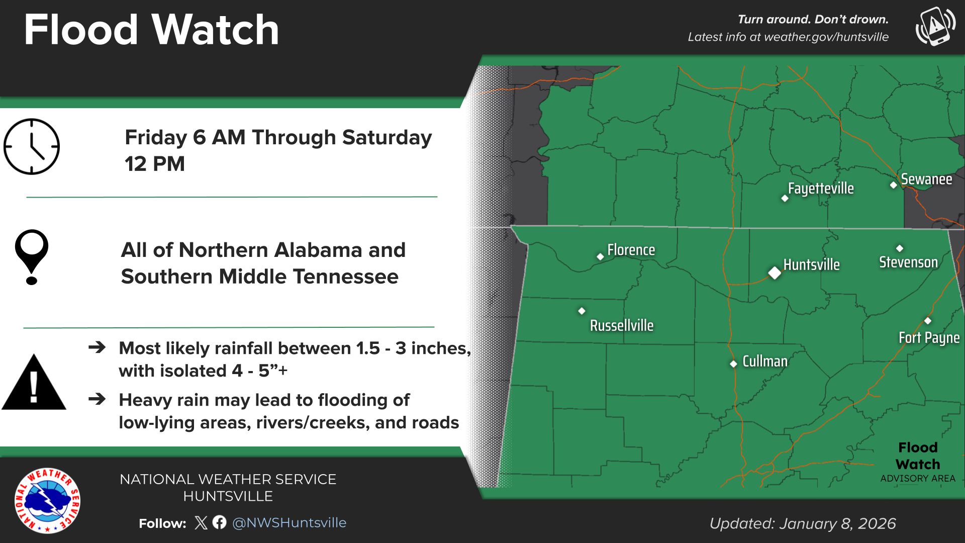
The National Weather Service (NWS) in Huntsville has issued a Flood Watch for all of northern Alabama and southern Middle Tennessee, effective from 6 a.m. Friday through noon Saturday. Forecasters warn of potential flash flooding due to expected heavy rainfall during the first major storm system of 2026.
The watch covers a broad region including cities such as Huntsville, Florence, Cullman, Russellville, and Fort Payne in Alabama, as well as parts of southern Middle Tennessee. Most areas could see 1.5 to 3 inches of rain, with isolated higher amounts of 4 to 5 inches possible in spots where thunderstorms persist.
“Heavy rain may lead to flooding of low-lying areas, rivers/creeks, and roads,” the NWS stated in its advisory. Residents are urged to exercise caution, especially in flood-prone locations, and to remember the slogan: “Turn around. Don’t drown.
“This storm system, part of a series affecting much of the central and southern U.S., is expected to bring rounds of showers and thunderstorms starting Friday morning and continuing into Saturday. While the primary concern is flooding from excessive rainfall, there is also a lower risk of severe storms, including damaging winds and isolated tornadoes, particularly in parts of Alabama.
The NWS advises monitoring updates via weather.gov/huntsville or following @NWSHuntsville on social media. Authorities recommend preparing now by clearing drains, avoiding unnecessary travel during heavy rain, and having multiple ways to receive weather alerts.This event marks an active start to the year’s weather pattern, with additional rain possible into the weekend across the Tennessee Valley.